Strategic Masterplan for the City of Artashat
The Ararat region and City of Artashat were chosen specifically for their vital geographic location:
- In close proximity to the capital of Armenia – Yerevan and to the Zvartnots International Airport (26km).
- Is on a railway route and contains a rail station.
- All settlements of the region are located along the strategic North-South route.
- Connects Yerevan to the Southern regions of Armenia and on the shortest route to Artsakh.
- Contains development of agriculture, production of building materials, mining and natural stone processing.
- Finally, during the post-Soviet years, there was no development in the region. Artashat’s population decreased from 32,000 to 21,000 people. The industrial complex fell into disrepair, with only a cement plant preserved in Artashat. Other cities and villages in the region are in a similar state. Extraction and processing of natural stone is the only industrial activity in the region that has remained prominent and increased throughout the years.
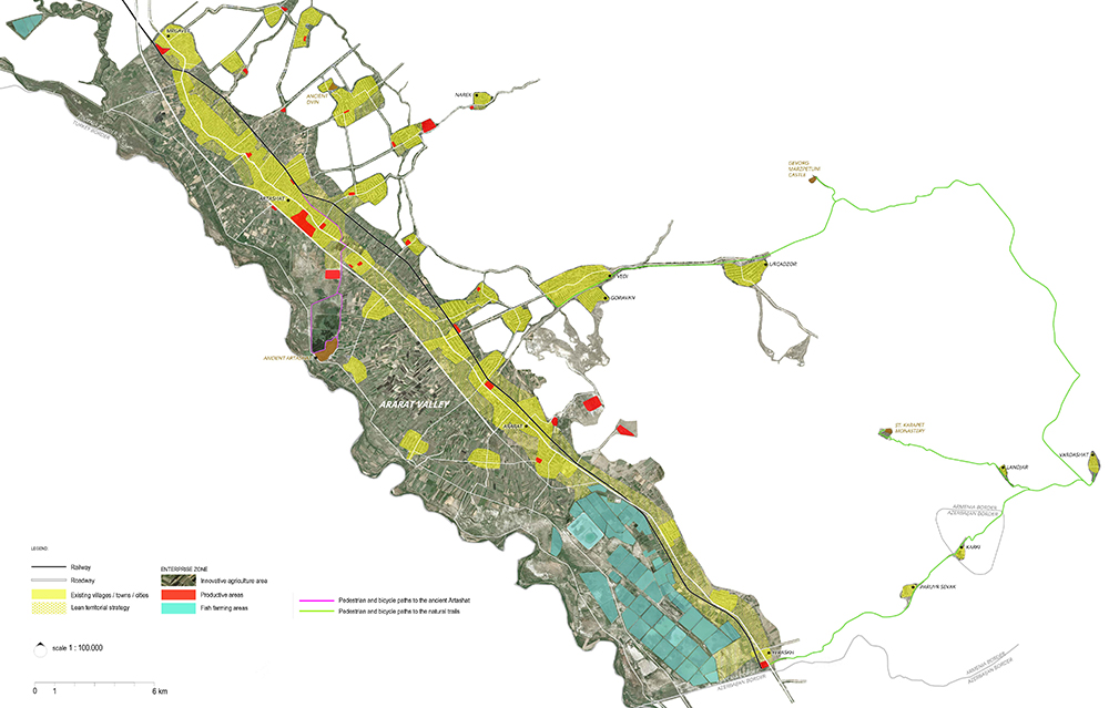
The region has unique landscape features that are different from the rest of Armenia. Here one can find the most beautiful views of the biblical Mount Ararat, a symbol of the Armenian people. The region is rich in cultural, historical, and architectural monuments. The site of Historical Artashat (10km south of present-day Artashat) has been the capital of Armenia for 400 years. According to the legend, this historic site was built by King Artashes I, as seen on the drawings of the famous Carthaginian commander Hannibal. Currently, this location is home to Khor Virap, a monastery that played a crucial role in the advancement of Christianity in Armenia. Geghard Monastery, Dvina Citadel, Gevorg Marzpetuni Fortress, Kakavaberd and Tapi are other historical treasures in the region. In the seventh century, the famous Armenian purple pigment — Vordan Karmir was made here.
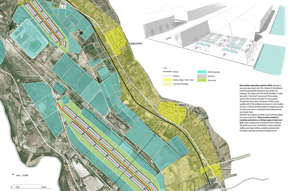
Modern day Artashat acquired its name in 1945. The population of the city increased from 1939 to 1989 from 4,148 to 32,000 people. According to the 2008 population census, Artashat was home to 20,900 people. The local population is mainly engaged in agricultural activities, but the regional industry remaining underdeveloped. The region also manufactures agricultural products, alcoholic and non-alcoholic beverages, tobacco, and mineral water. Fish farming and extraction of travertine stone (type of limestone) is taking place in the southern part of the region. According to the 2008 statistical data, the Ararat region’s industrial activity was at 8%, while its agricultural activity was at roughly 13%.
The tourism industry is absent in the province, despite it being home to three natural reserves – Khosrov, Gorayan Sands, and Khor Virap natural park. In 2012, the Government of Armenia approved a program for the restoration of the Natural Park “Sands of Horovana. The Ararat province holds most of Armenia’s natural travertine quarries, the only production facility of ceramic tiles, brick production facilities, as well as a cement plant in the City of Artashat.
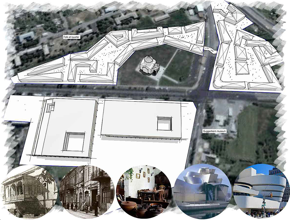
The Jeweller’s Quarter is the creation of a tourist-themed neighbourhood near the Church of St. Hovhannes that encourages the involvement of developers, business owners, and other stakeholders. Private companies could include local and international jewellers, as well as Armenian designers from across the globe. To promote and develop this concept of a jewelry center with regional importance, it is necessary to market to jewelry connoisseurs and boutique companies, and develop a program of cultural events and activities in the Quarter, ensuring necessary infrastructure is in place for development.
School of Fine Arts and Crafts
Creation of an learning center will partner with independent educational institutions such as some well-known European schools. Training programs for the center must comply with international standards. Graduates can get a European Bachelors while studying in Artashat. This institution will have inter regional significance.
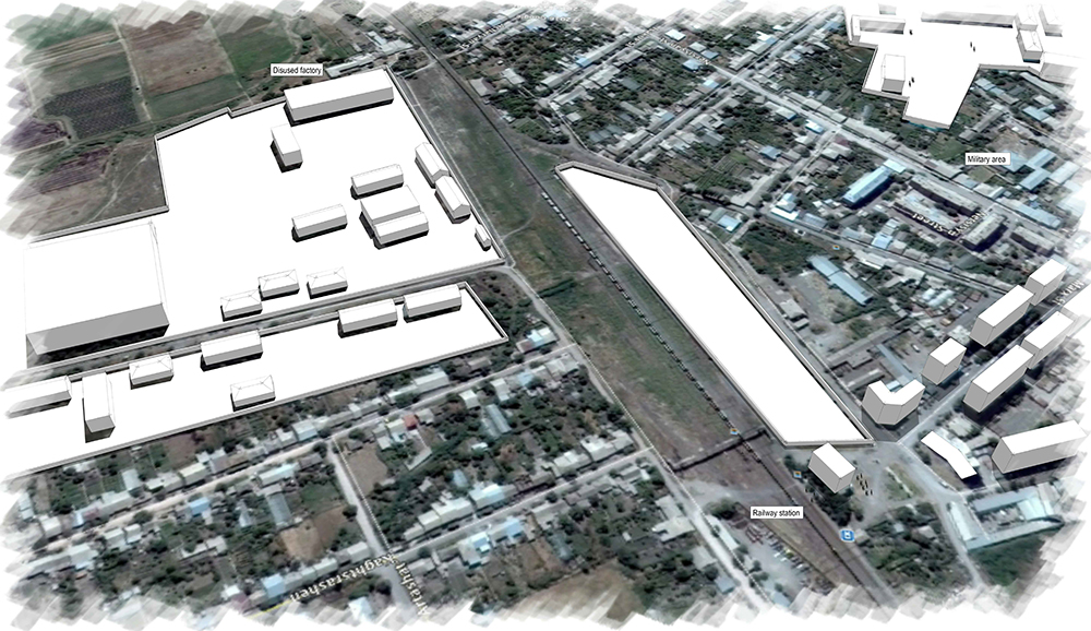
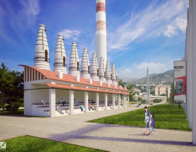
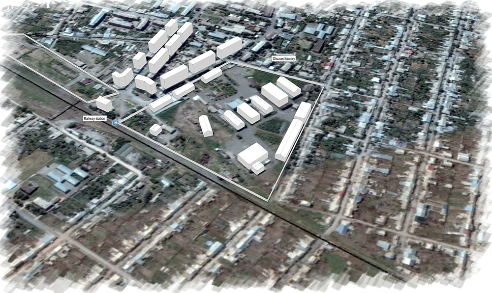
The site is located north of the city, near the existing railway station in the village of Vostan, where an
abandoned textile factory is located. Close proximity to the railway station and future bus station ensures that the school is accessible to children in both Ararat and neighboring areas. There will be a hostel or a student dormitory for visitors of the learning centre.
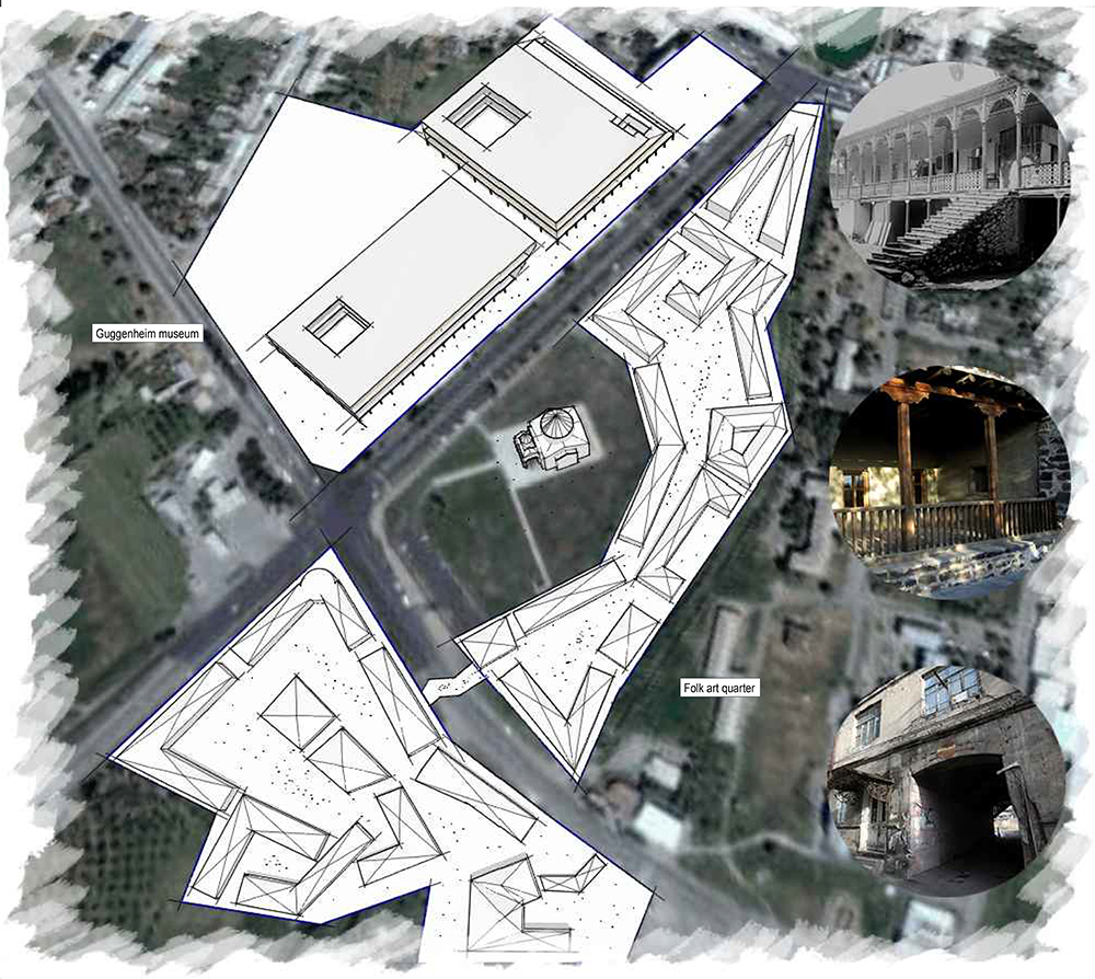
The idea of building a museum is not limited to producing a physical product. It also includes establishment of processes, services, modes of interaction, forms of education, development of culture and entertainment, and lastly, interconnection and cooperation with other museums and cultural institutions of the world.
Creation of a committee with some government official members will help in the organization of an open international competition to choose the best design of the Museum of Modern Art. Alternatively, foreign experts and Armenian art historians can be welcomed to contribute to this museum. The museum can possibly move in the direction of hosting extensive programming of exhibitions, and scientific, educational, and publishing activities. The Artashat Masterplan development will see to establish a fund for the construction of the museum.
The museum will feature ethnographic exhibitions and will be dedicated to culture and art of the peoples of the world. For this, there will be site analysis and preparation in Artashat’s northeast, opposite of the Church of St. Hovhannes. Demolition of blighted housing (mainly five-story residential buildings built in the 70s) will occur on the site of the future museum. Together with the church and the Jeweler’s Quarter, the museum will be the hallmark of not just the city, but the entire region of Ararat.
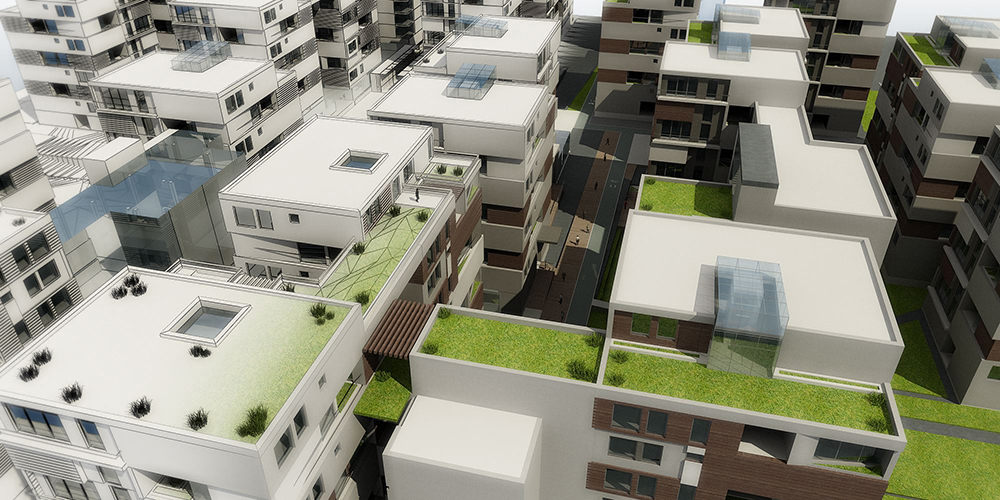
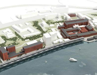
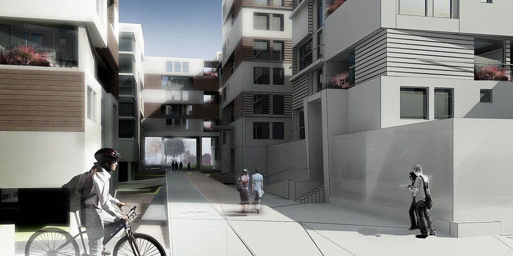
- Architectural appearance of the city of Artashat and the region as a whole will change with the construction of modern residential buildings of varying typology, as well as with the introduction of public spaces and a cycle network.
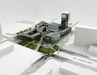
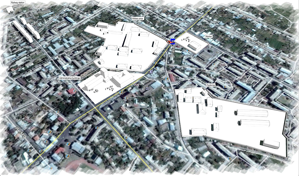
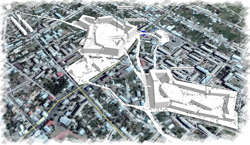
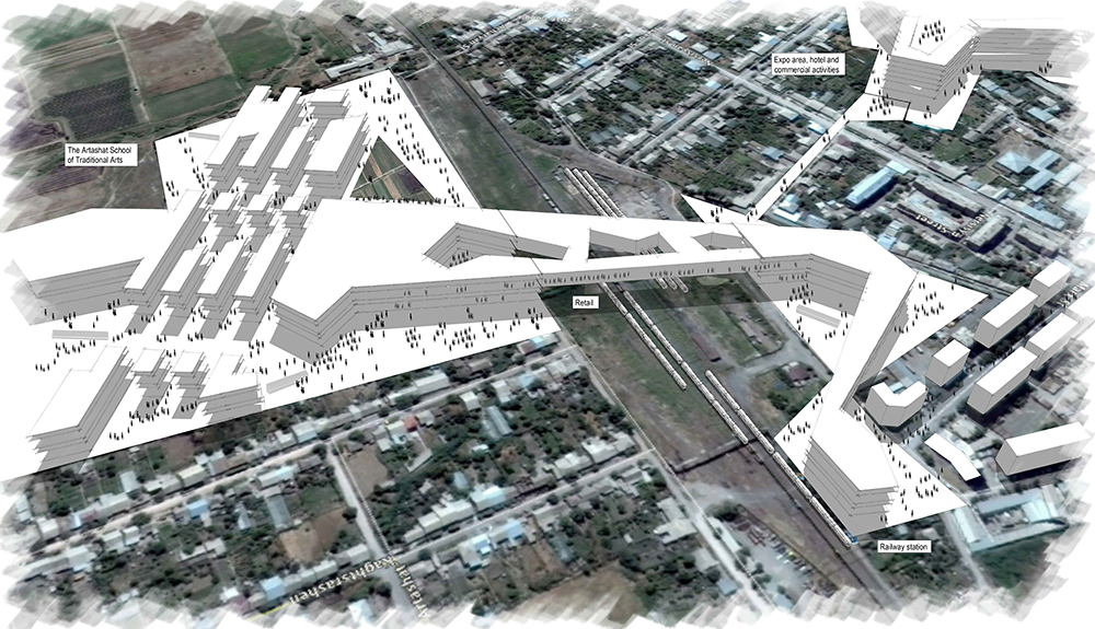
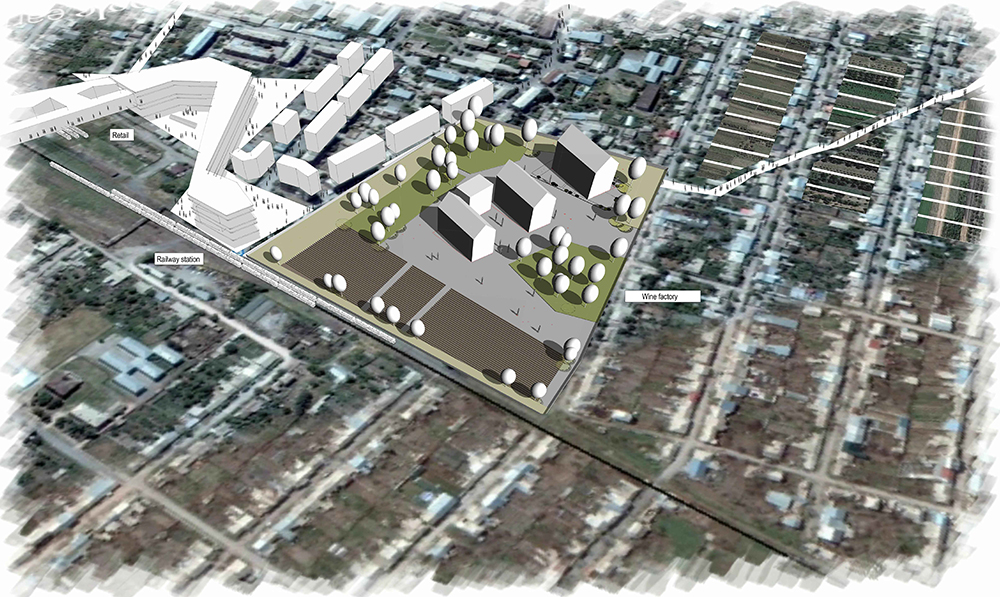
- Railway Station Redevelopment: The transit station will be transferred from the city center to a site near the railway station, a shopping and entertainment center will be constructed along with the School of Fine Arts and Crafts. Further, the central square will be reconstructed to become the public center of the city, and the cultural center will be restored. The local municipal department will be transferred to a new building, city hall will be reconstructed as a hotel with shops on the first floor.
- Central Square Redevelopment: the central square will be reconstructed to become the public center of the city, and the cultural center will be restored. The local municipal department will be transferred to a new building, city hall will be reconstructed as a hotel with shops on the first floor.